
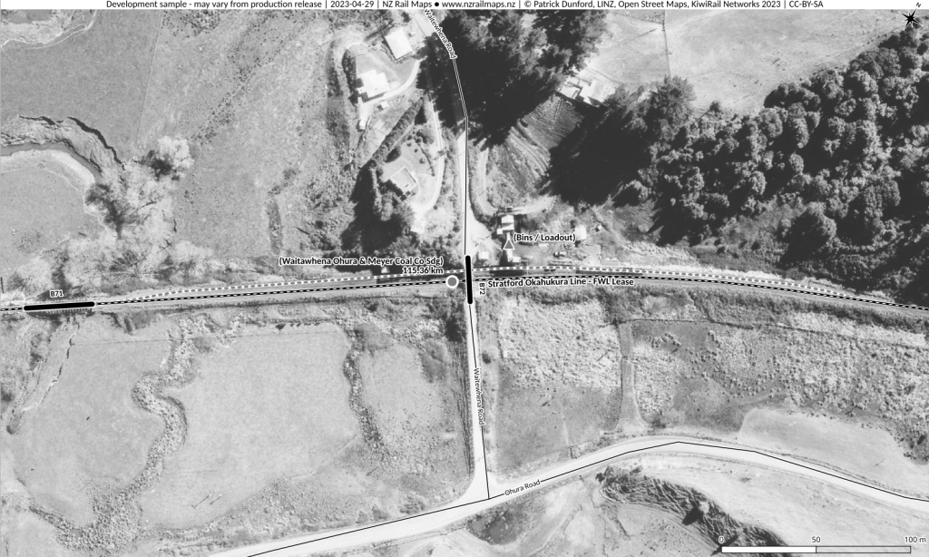
This week, work has focused on receiving the latest batch of aerial photos that have come in from the Crown Aerial Film Archive via Linz. These are all for the Midland Line, and cover both the main line and the branches of the Midland Line that are currently being worked on for maps development and production. Having this detail means additional map information can be produced for stations on the main line between Otira and Greymouth, and for the branch lines to Rapahoe, Rewanui and Ross. This week work has focused exclusively on the Midland Line except for a short time getting map and historical information for Waitawhena Siding on the Stratford Okahukura Line and Ngapuna on the Otago Central Branch. Data is included here for Waitawhena, but the maps for Ngapuna need a little more work and may be posted at a later time.
Whilst looking at Waitawhena it was noted quite a lot of work is needed to bring the Volume 4 maps up to current standards, and that in any case not much in the way of aerial mosaics has been completed in current formats for Volume 4 except for Whanganui / East Town. A few smaller maps have been produced for Patea and Waitotara, but the small amount currently on record seems strange considering the amount of work done with Volume 4 in the past. However, prior to the use of Qgis, quite a number of maps around NZ were georeferenced using Google Earth, and it was not possible to import such georeferenced material directly to another platform; therefore, all these maps had to be discarded and everything done again from scratch onto the current platform. The current methology of producing GeoJpegs generates platform independent output, so there is no likelihood of having this issue again in the future. Both Patea and Waitotara were completed in lower resolution aerials of poorer quality, but CAFA has what appear to be NZR station surveys for these areas so work will be undertaken with these in the future. There are however no current plans to do intensive work in V4 and if a volume appears later this year it will probably only have basic coverage; all the tracks of current lines and km pegs having been copied from Kiwirail’s CC licensed layers. The standard for work on all the volumes to be completed this year will probably just be the main stations that have NZR surveys available in addition to whatever else has been completed already in those volumes.
Current intensive work on the Midland Line can be justified on the basis of the special situation with the line’s anniversary coming up, but the deadline has been set for the end of May (4 1/2 weeks) and will be strictly adhered to. This means some prioritisation, especially as during that time it is unlikely that more than one more batch of aerial photo requests can be obtained within that timeframe, and that there will be a delay in obtaining them. So, mapping some of the bush tramways south/east of Ross and Ruatapu has been relegated down the priority list and won’t be included in this edition of Volume 9. Instead, the main priority will be refining the main areas of railway corridor coverage to fill in some extra details. Mainly, some extra coverage of the Ross Branch to fill in details of some of the smaller stations that closed in the early 1970s will be sought, along with several areas around Greymouth. There is still a lot of small details like individual smaller stations along the Midland Line and Hokitika/Ross lines in particular, and the Rapahoe and Rewanui branches to complete at this time.