Good evening and welcome to our Project Development Report for August 2021. In the past month the main areas worked on have been maps in the Picton Section (Main North Line), and recently work on the North Island Main Trunk in Palmerston North. The latter has considerable historical interest as the main trunk line used to run down the middle of Palmerston North’s main street until the mid 1960s, and there are plans afoot even as of now for a second relocation of the Palmerston North freight yards, this time to Bunnythorpe just north of the city. Adding this content helps to progress a minor update of Volume 5 in preparation for its addition to the Volumes site when that goes live, we hope later in the year. All the existing Volume 5 static maps will be reproduced in the new layout at that time, but for the most part the data in them will be unchanged except for Wellington, Palmerston North and one or two smaller stations. Wellington station maps are being upgraded with additional information about the Wellington & Manawatu Railway yards in Thorndon.
During the month, in addition to producing these maps, the Volumes static map formats and their web site have received attention. The new web site remains under development but has slowly progressed with the implementation of a simple solution based on open source PHP scripts to replace proprietary WordPress plugins. This still needs our own simple WordPress plugin for full integration, but to start with we’ll get by with semi integration. Work is underway to rewrite the PHP scripts to make them work better with our web site format.
The static map design templates have been further upgraded this month and now incorporate a colour bannerhead across the top of each map. The reason for using greyscale in the bannerhead was that the map content (except aerial backgrounds) has always been greyscale to ensure correct colour rendering when maps are photocopied. This will remain the same for the foreseeable future, but the same issues don’t really apply to the bannerhead so we have taken the opportunity to modernise the look by colouring key elements.
The most recent update to the Volumes template is now to display within the bannerhead either the text “Combined Diagram” for diagram maps or “Aerial XXXX” where XXXX is the year for the aerial background. This is provided by a custom function within the Qgis layout composer that extracts the year from the filename field at the bottom left and much the same as the code that switches the layers in the GUI when a script is run to create the map image.
Last month we suggested the webmaps could get a weekly update as new data is added to the maps. This now appears unlikely as the speed of adding new data varies a lot, with in the last month a lot more work going into other aspects of the project. A monthly target is more likely but is not guaranteed. So at the present time, webmaps upgrades will probably be limited to several times a year with indeterminate frequency. This is because our low-tech webmaps production system relies on manual steps to get the data from the GUI into the webmaps website – even with scripted automation there are still a few steps involved. We’d much rather prototype each section of maps as Volumes, get them out into the public and wait for feedback and fix any found mistakes before they go onto Webmaps.
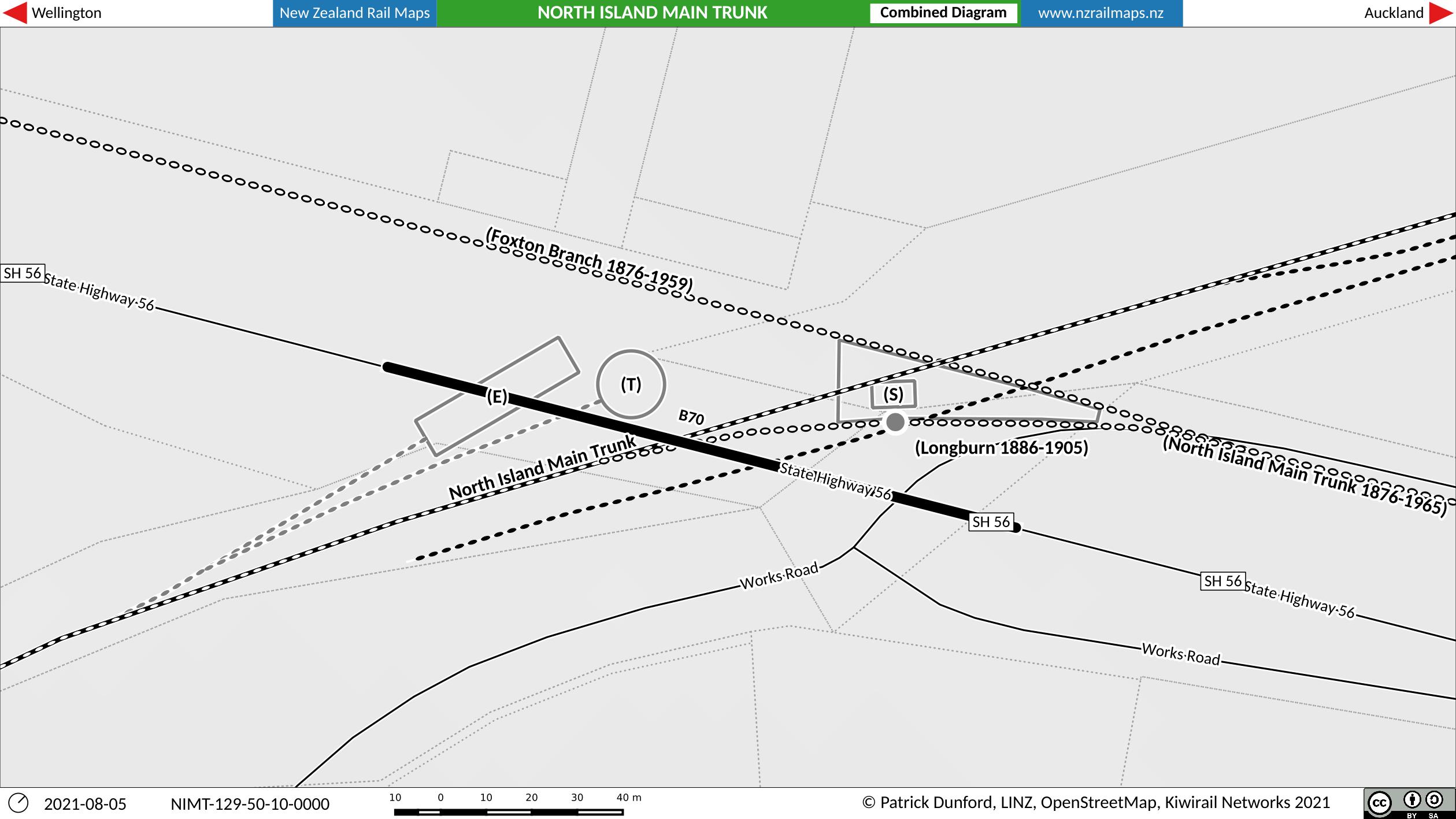
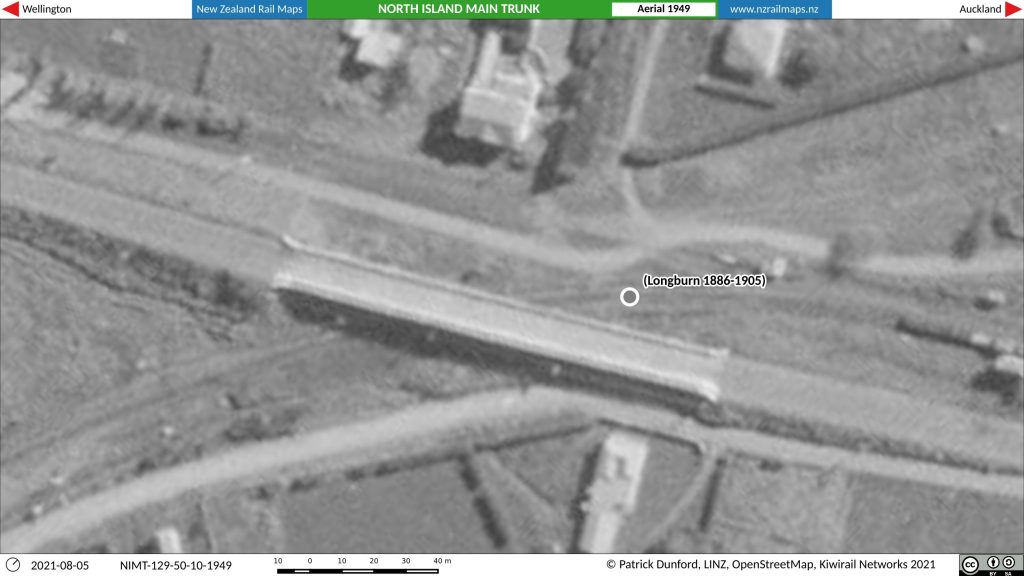
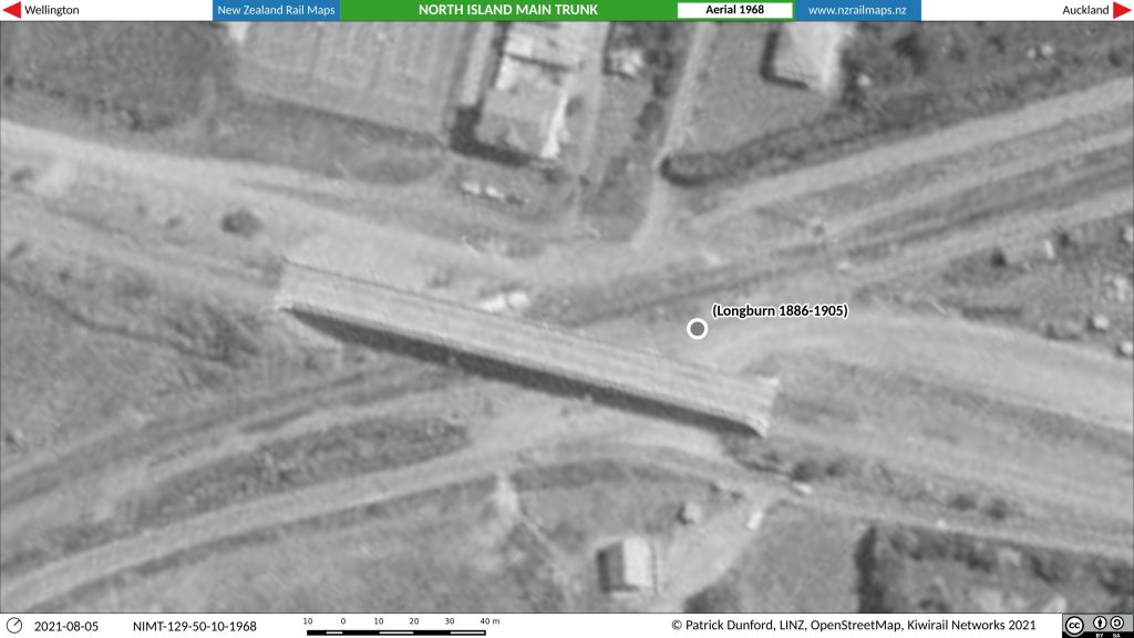
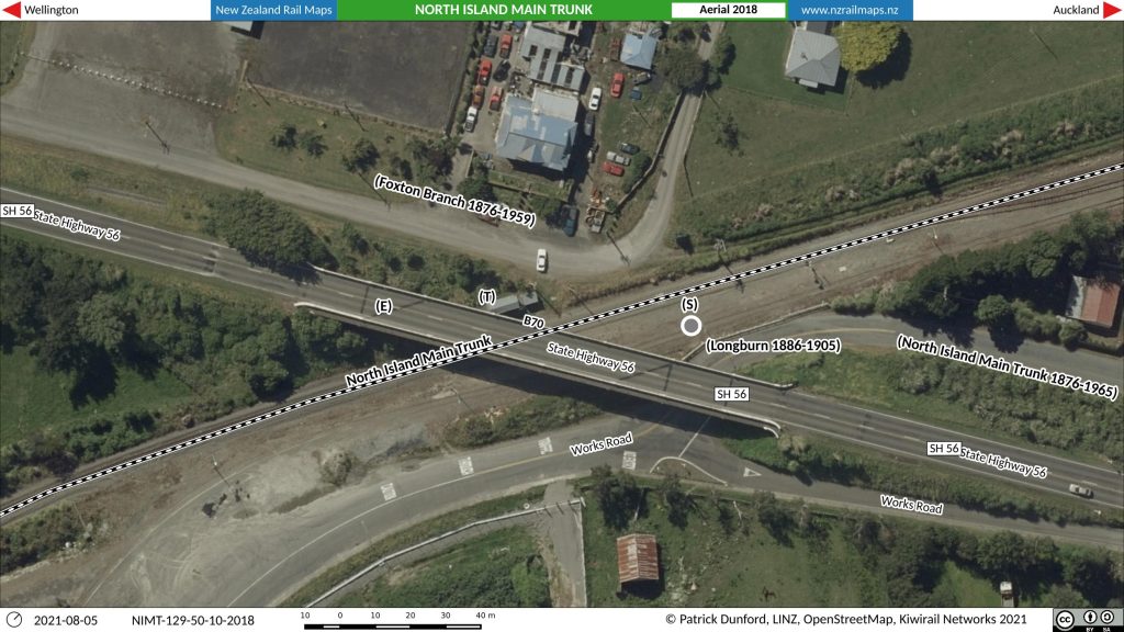
Here is a diagram and aerials for the 1st or 2nd Longburn station, which was the terminus of the Wellington & Manawatu Railway from Thorndon between 1886 and 1905. From 1905 to 1962 Longburn was to the east of this location on the old main line through the centre of Palmerston North, and its present location since 1962 has been to the north of this location, as part of the first stage of opening the Milson Deviation in the mid 1960s.